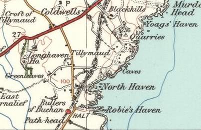
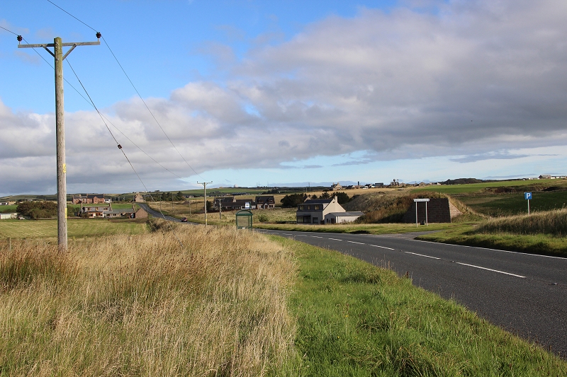
Map. From the Bullars Halt Site towards Longhaven..
Quarry Line To Cruden Bay
(Update 19th Sept. 2016 and October 2016)
Returning
to the mainline track bed I continued towards Buller's. It looked as
if the track bed would go on forever and the railway easily reopened
if the thought was there.
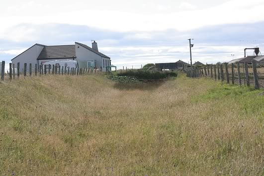
However, I was stopped from getting there on the track bed by a garden
fence and the line being blocked on the other side of the railway
bridge by a Sawmill that had taken
over the ground right up to the railway perimeter. Walking this
section of track bed was quite comfortable and a real pleasure in the
sunny conditions of the day, but with
so much long grass it really needs to be nice and dry, as it was in
this instance. You do need to tread carefully as there is some rough
ground and the odd pothole that
could catch you out.
Map. From the
Bullars Halt Site towards Longhaven..
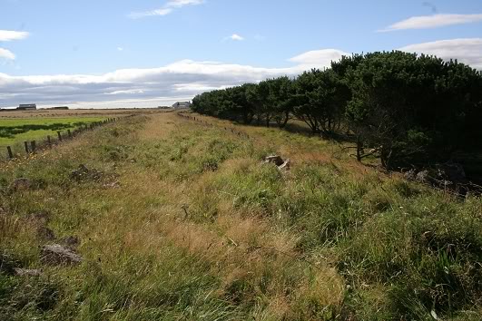
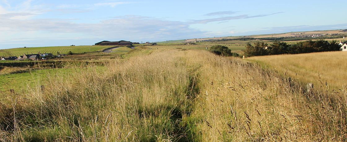
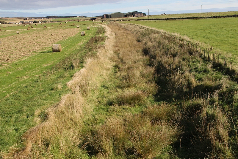
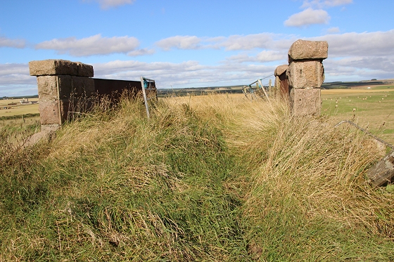
An attractive tree-lined edging to the wide track bed
as it goes towards Cruden Bay. Right: A long right hand curve led me up to the dead end where
the owner of the house up ahead has
fenced off the railway.
From
the same spot, looking back towards Boddam. Is that a train whistle I
hear! Right: The 'road' block. The only way out was to climb over
the fence on the right and walk along the
edge of the field, where thankfully a break in the fencing by
the railway bridge allowed me to get out.
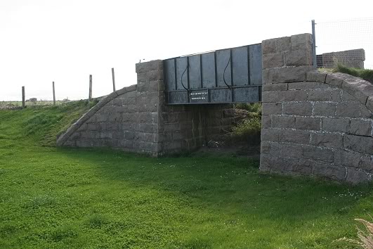
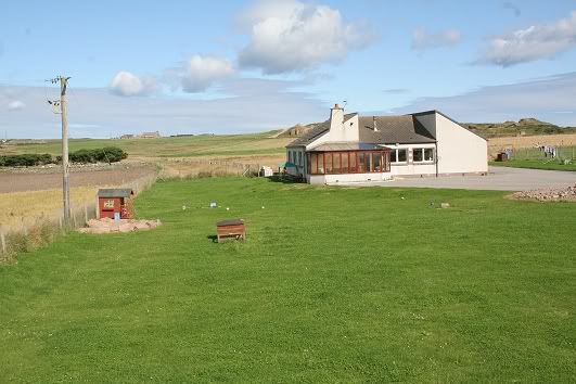
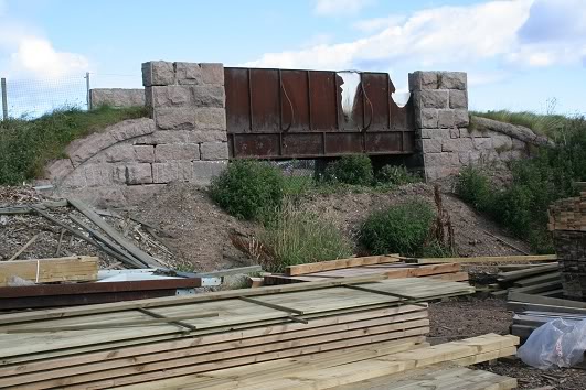
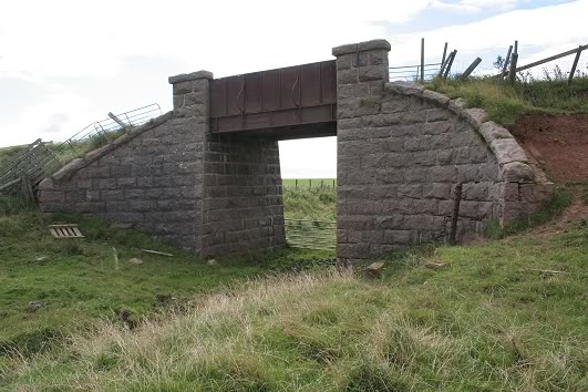
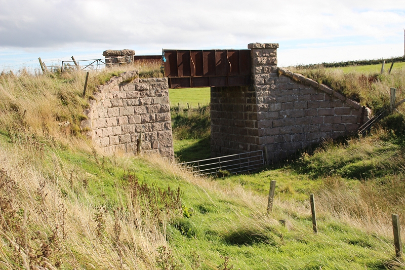
The bridge looks quite good from this side. The
well-groomed garden probably helps to keep people at bay. Right: The view from the bridge towards Boddam shows a neat
scene and a
very pleasant modern house. The garden has been extended by
back-filling the low cutting towards the bridge Behind the house on
the left you can see the stone structure by the quarry
track bed and to the right the quarry area.
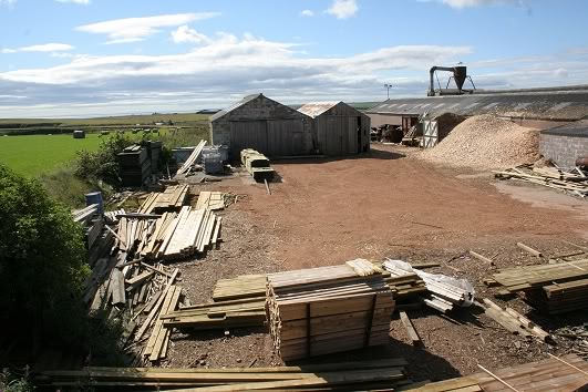
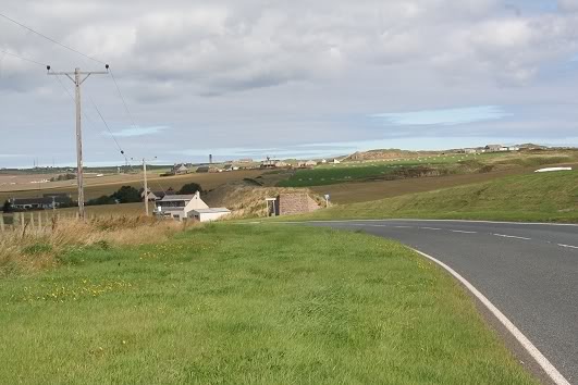
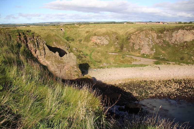
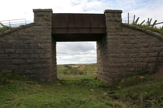
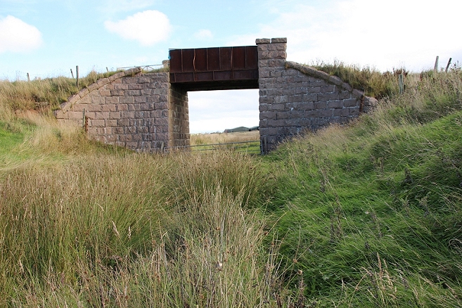
The view towards
Cruden Bay. The saw mill has blocked my progressing towards Bullars.
The only thing was to walk around the main road, which is a fair
little walk compared to the
direct distance on the track bed. Right: The western side of the railway bridge tells a
different story. Both stone and metal work are badly corroded.
Again, I asked permission to enter
the grounds. Update: You can get through to the track bed but you
will have to ask permission at the Saw Mill.
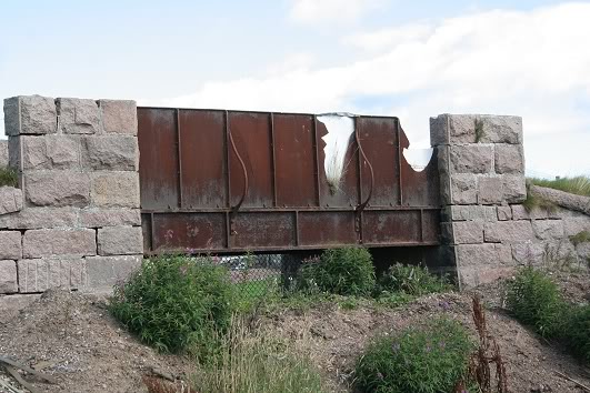
Ditto.
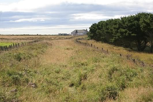
Right: Back on the main road with the railway embankment
running towards Bullars where it comes to another abrupt end.
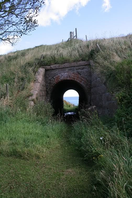
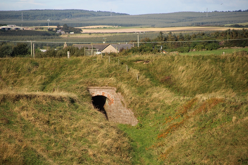
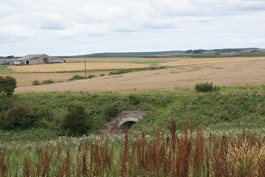
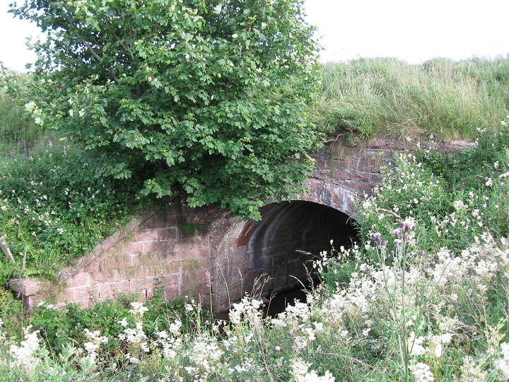
An interesting culvert below the embankment that lads
to North Haven by the North Sea just
ahead. There is an interesting mix of dressed granite and red brick
used for the tunnel.
I tried to get up onto the track bed but it was just too difficult
on both sides. The path leads
to the Bullars. Update: I have since found that you can get up onto
then track bed from
the other side. There is an opening on the right.
At the road
junction for the Buller's O'Buchan the railway has virtually been
wiped away for about half of a mile. The buttment is in quite good
condition but some of the outer stones are getting to a stage
where they could fall from their settings.
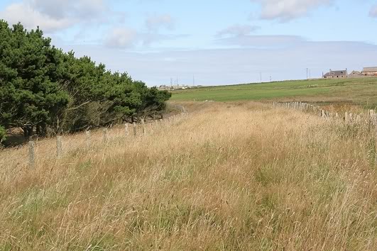
Right: The embankment from the north west side, looking
towards Boddam. You can see the Sawmill, and there is also a fence
blocking the track bed,
but which doesn't look impossible to pass. Update. I have
since found that you can get past the fence.
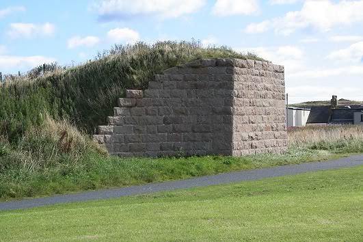
Buller's
Halt stood a little way to the left of this scene, where the track
bed has been completely demolished.
The trackbed runs towards Boddam. The Sawmill is seen in the
background. This side road
takes visitors
to the Bullers O'Buchan .
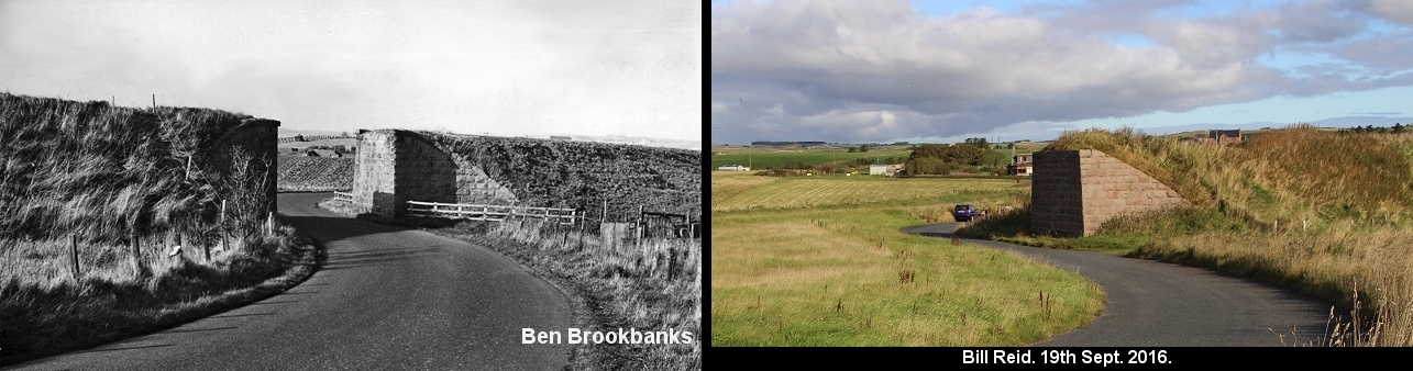
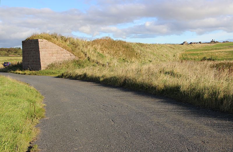
Left: The site of Bullers O' Buchan Halt and
the over-bridge before the south embankment was removed and the new
road bypassing this spot. It must have been quite a dangerous corner
for road traffic
and of course, for hight limitation for lorries. The Halt was on the
embankment to the left, just out of site. Right: Present
day setting. The S bend in the old road is still the same. The new,
wider road
runs along the darker green strip running horizontally just behind.
You can see the roof of the house behind the embankment to the right
of the embutment in both photos. Likewise, the white house
seen center left in my photo is also, just, seen to the left of
the embutment in Ben's photo. Likewise, the field beyond the S
Bend in the distance is still being cultivated today.
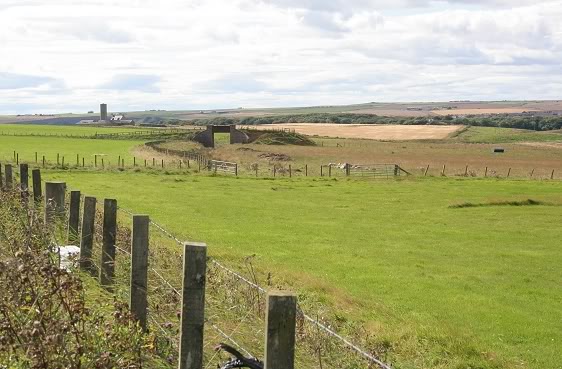
Looking
back at the remains of the road bridge, with the quarry in the
background. This was approximately the site of Buller's Halt, which
stood on the removed embankment. The power station
chimney at Boddam can be seen in the distance, as well as the Sawmill
chimney.
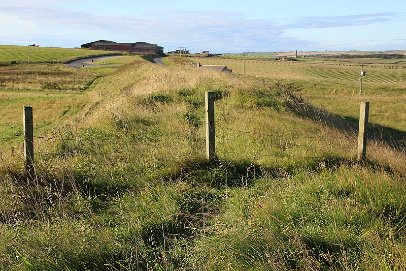
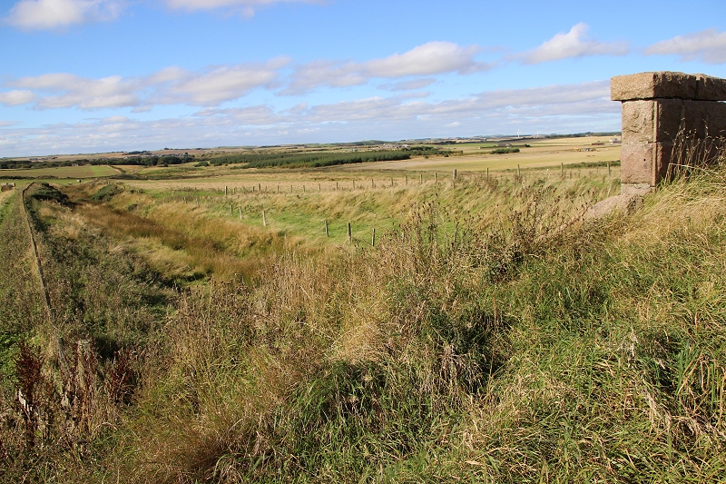
Right: The
track bed is seen winding its way into the distance. The quarry link
can just be made out as it runs to
the quarry to the far right. Again, the Power Station chimney at
Boddam is seen.
Update Sept. & October 2016
I managed to return to this site and to walk
over the track bed northwards to where it is cut-off by the Saw Mill
and back again. From here I walked over the the Bullar's and the
small hamlet.
I returned to the old road and walked down towards Cruden Bay, past
the site of the old Halt where I got back onto the track before a
short distance. My aim was to walk the track bed down
to the road junction at Cruden Bay but the way is blocked by the
meeting of three field fences, so had to return back to the over
bridge and onto the main road. However, instead of walking
the road I decided to take the path leading to the ruins of Slain's
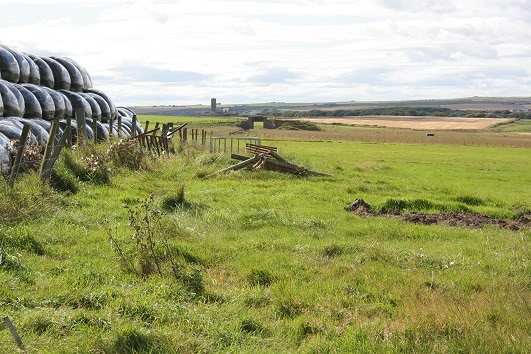
Castle and the path down into Port Erroll village.
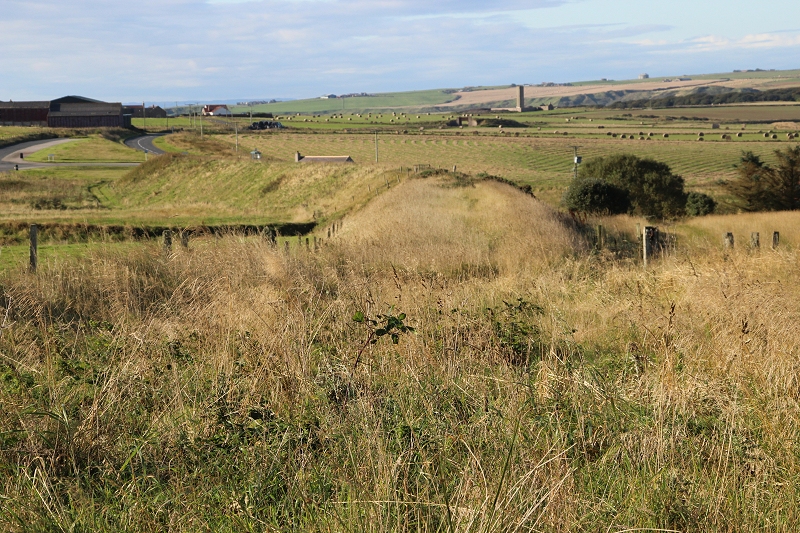
On the embankment appx. half way between the
Saw Mill (Behind) and the site of Bullars Halt.
This wide view shows how much of the south
side over the over bridge and it's embankment has been removed.
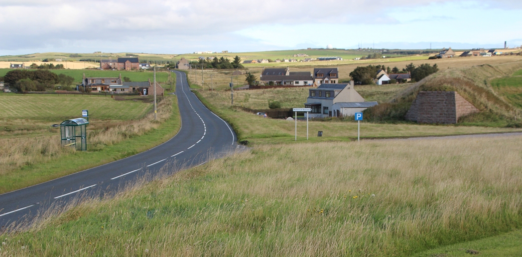
View from
the southern end of the embuttment, showing the new road curving
past the site of Bullers Halt and where it cuts off the
embankment. The plastic bales stand on the track bed. Just as the
halt served the Bullars a modern bus stop on the
Aberdeen-Peterhead
service does the same job today. This was very conveniant to me as
this is where I got off the bus from Aberdeen to start my walks.
The new
road by the site of Bullars Halt and where it cuts the railway
off. Shows how the embankment and south side of the railway bridge
has
been demolished.
Half way on the embankment, looking southwards towards Bullar's Halt site and to Cruden Bay.
Above the culvert bridge that leads to North
Haven. This was fenced off but is now passable. Top right you se
the dome of the Boddam RAF base.
Directy ahead the track bed is cut off by the Sawmill and the
back-filled over bridge.

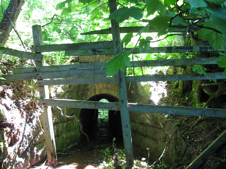
The culvert below the track bed. This leads
on a rough track from the AA90 to North Haven & the
Bullars O' Buchan.
From North Haven. The culvert with the
track bed running from left to right across the top. Taken from the path
half way from the Bullars.
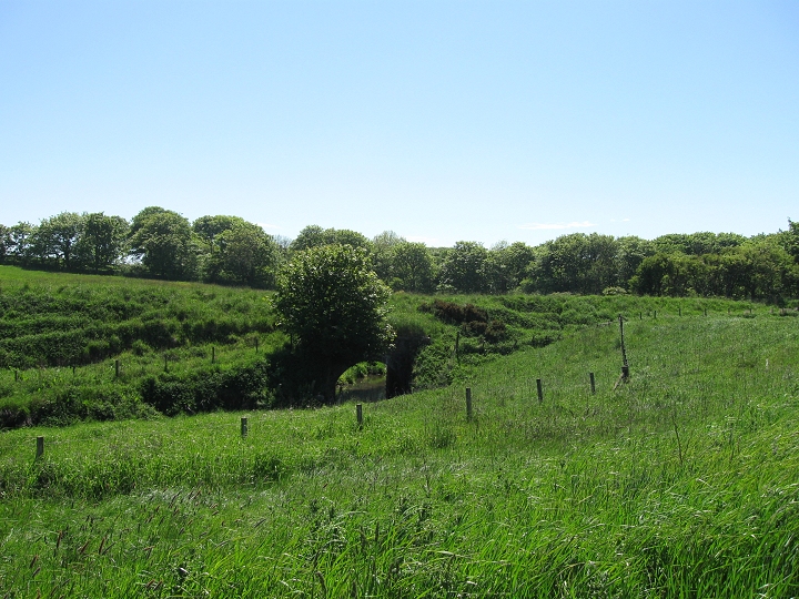
A wide angle view from the path near
North Haven & Bullars O' Buchan.
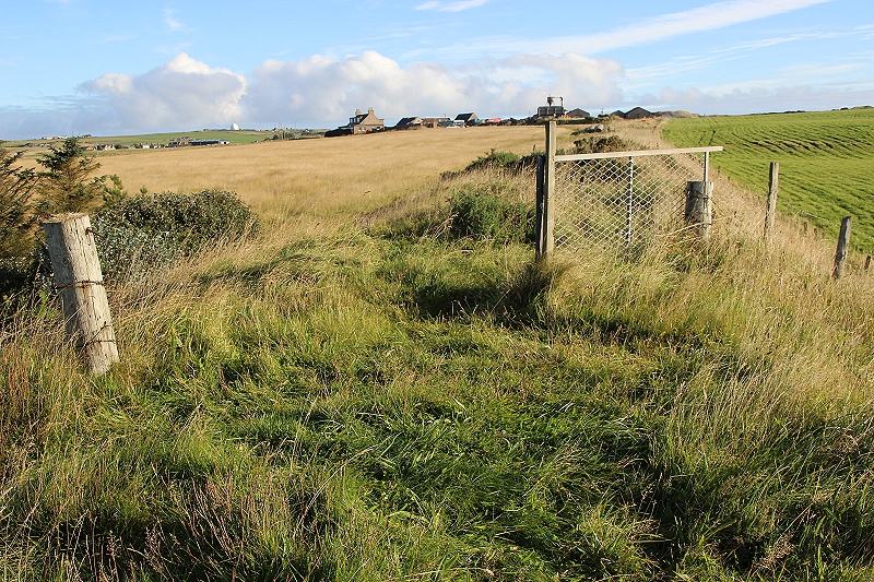
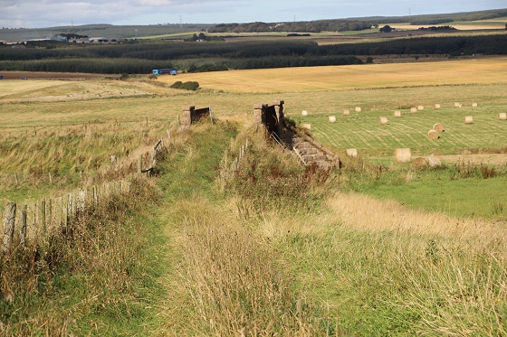
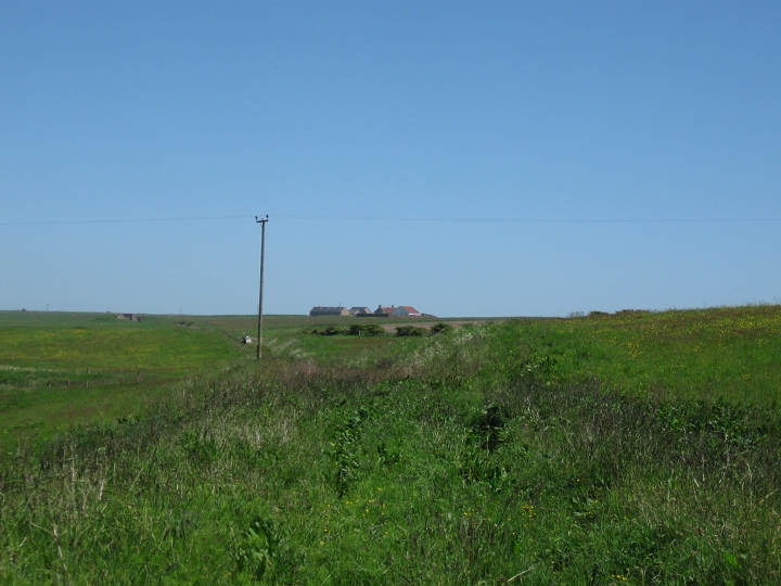
From close to the Saw
Mill, the embankment runs southwards to the site of the halt then
curving down to the farm over bridge and down to
Cruden Bay on the far right. The stack seen in the background is
the remains of Foutainblue Farm. Top right, you see the new
road cutting
off the old road and the railway.
==================================================================
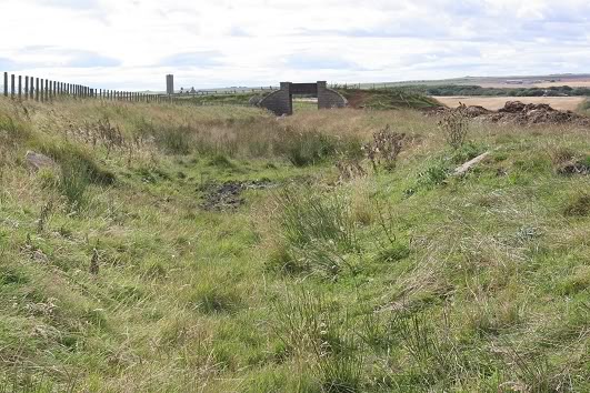
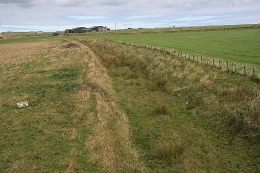
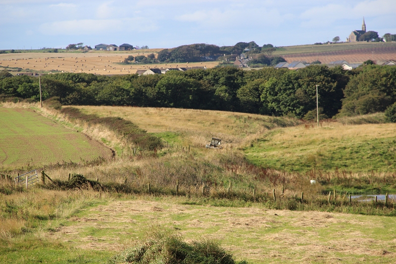
Continuing my walk from Longhaven where I rejoined the track bed by the old farm access over bridge.
The railway track bed is found again towards Cruden
Bay. It ran off the embankment and became a shallow cutting before
going below the bridge in the distance, towards Cruden Bay.
Left: This is where I first thought where the Halt had
been . Right: This sight
has all the feel of a railway station that fooled me when I first
came across this site.
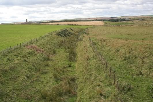
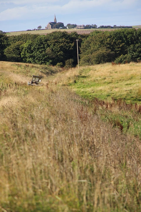
This is on a rising gradient and the shallow cutting led to the
embankment where the Halt stood.
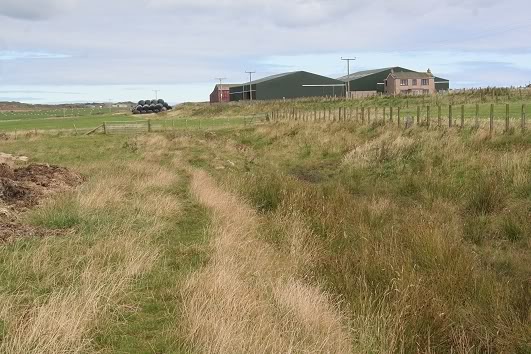
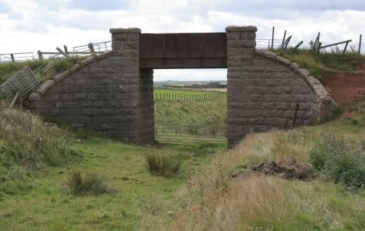
Looking back towards Boddam. The path by the gate,
running up to the main road had been a farm level crossing. Right: The bridge is in quite good condition but some of the
ground on
the right is crumbling. This was simply a farm access bridge from
the main road.
Central view, looking towards Cruden Bay
A view from the bridge, towards Boddam. Right: A view from the bridge, looking towards Cruden Bay,
seen in the distance. The track bed is clear enough to walk up to
the treeline but from a
previous visit to that end of the line I knew that there was no easy
way out, therefore I decided to walk the main road to the outskirts
of the village.
Update. 17th Sept 2016
On this visit I attempted to try and walk the track bed
as far as possible down to the Ex over bridge remains at the road
junction for Peterhead and Aberdeen. Just before the site of
the old Brick Works. However, I only got about a quarter of
the when my path was blocked at the site where three farms
joined together and heavily fenced off. That was a
disappointment as I had to turn back towards the farm over bridge to
get back onto the main road. However, even if I had been able to get
to the Ex over bridge at the road junction I
couldn't be certain that I could get back down off the railway as
seeing this from the ex over bridge on a previous vsit I was unable
to get up on the track bed at that spot, so perhaps
it was for the best.
A view of the bridge on the Cruden Bay side. The bridge
is gated and locked, which meant another
scramble to get back up to the main road and walk into Cruden Bay.
The south side of the farm access
bridge.
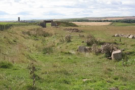
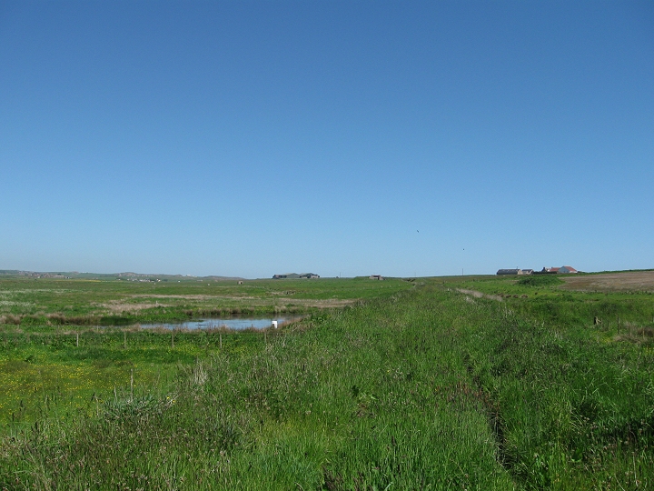
View from
the over bridge. Northwards towards Boddam. Your eye is led to
the plastic-covered bales that stand on the track bed
and beyond you see the embankment running northwards to the
next station stop which was Longhaven.
View from the farm access over bridge.
Southwards towards Cruden Bay. Ex Foutainblue farm to the left. Note
the tall rushes which keep this section
very wet and boggy.
Two views of the farm access bridge from the
main road.
A view,
southwards from the over bridge. A discarded boat lays on the track bed
up ahead. The track bed drops quite steeply and curves towards the gap
in the trees and the Ex road over bridge at the
Fraserburgh-Peterhead road junction.
Telescopic view from the fence that stopped me
getting down to the end of the track bed at
the road junction by the demolished over bridge. The high church
appears closer than it
really is, on the southern outskirts of the village.
====================================================
-
Left: A telephoto view of the
bridge from down the main road to Cruden Bay. The line ran in
a cutting then on an embankment on the approach to Cruden Bay.
This is looking towards Boddam. Right: A culvert close to the trees that blocks the way from
walking the track bed to the demolished road bridge, as mentioned.
Update December 2016 (By Fraser Ross).
This
fills cvers the section from the farm access bridge own to the Ex
under bridge by the Fraserburgh-Peterhead road junction
that I didnt manage to get onto on my previous walk.
Looking northwards toward the farm access
bridge in the distance.
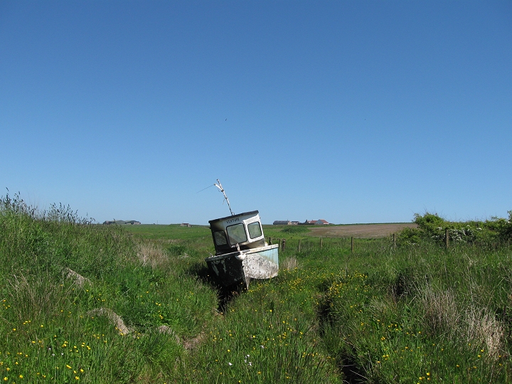
The abandoned boat.
North face
of the culvert with the railway embankment above.
Cruden Bay Woods culvert.
The track bed is just about noticeable at this spot.
===============================================================================
This
page brought to you by:
VintageHammond.Com - We Buy-Sell-Trade Vintage Hammond
Organs and Roll or Kari Organ/Vending Machine Moving Dollies Order Roll or Kari Dollies Here